

The exceptionally heavy rainfall was linked to the combined influence of several weather systems that brought a continuous supply of moisture into southern Gujarat. According to meteorological assessments, the monsoon trough, a large-scale cyclonic circulation and a western disturbance interacted to create conditions favourable for intense rainfall over the region.
The rainfall event in Umergam was particularly significant in the context of India’s historical extreme rainfall records. The country’s highest recorded 24-hour rainfall total was reported from Sohra, formerly known as Cherrapunji, in Meghalaya, where 1,563.3 mm of rain was recorded on June 16, 1995. The second-highest figure was recorded at Aminidivi in Lakshadweep, which received 1,168.5 mm of rainfall on May 6, 2004.
The latest extreme spell in Valsad therefore stands out as one of the most intense single-day rainfall events recorded in the country. The scale of the rainfall also underlined the volatile nature of the southwest monsoon, particularly when multiple atmospheric systems interact over a relatively concentrated geographical area.
Multiple weather systems fuelled intense rainfall
Meteorological conditions over western and central India played an important role in the exceptional rainfall over south Gujarat. A large-scale cyclonic circulation in the lower and middle levels of the atmosphere was positioned over central Madhya Pradesh before shifting westwards towards southeast Rajasthan.
At the same time, the monsoon trough was located south of its normal position. The trough extended across parts of Rajasthan, Madhya Pradesh and central India before continuing towards the northeast Bay of Bengal. Its southward tilt with altitude further contributed to the atmospheric conditions supporting heavy rainfall.
A western disturbance, present as an upper-air cyclonic circulation over Jammu and adjoining areas, also interacted with the prevailing monsoonal circulation. The combined effect of these systems helped draw and concentrate moisture over Gujarat, increasing the potential for intense rainfall over southern parts of the state.
Weather experts also pointed to a strong inflow of moisture from the Arabian Sea. The persistent movement of moisture towards Valsad and neighbouring parts of south Gujarat contributed to the development and maintenance of heavy rain-bearing clouds over the region.
Rainfall activity expected to shift northwards
The weather systems responsible for the intense rainfall were expected to gradually move northwards after affecting southern Gujarat. Meteorological forecasts indicated that rainfall activity could extend into northern Gujarat and subsequently move towards Rajasthan.
Although the intensity of the rainfall was expected to decline, isolated areas could continue to experience heavy to very heavy showers. Valsad remained under an orange alert for Friday, indicating the possibility of significant rainfall in isolated locations. A yellow alert was expected for Saturday, although some pockets could still receive heavy rain.
The change in the position of the weather system was expected to shift the focus of intense rainfall away from south Gujarat towards parts of Rajasthan. However, the movement of the system did not immediately eliminate the risk of localised flooding, waterlogging and disruption in areas that had already received exceptionally high rainfall.
The combination of saturated ground conditions and further rainfall could increase the risk of flooding in low-lying areas. Rivers, streams and drainage networks may also come under additional pressure following such an extreme rainfall event. 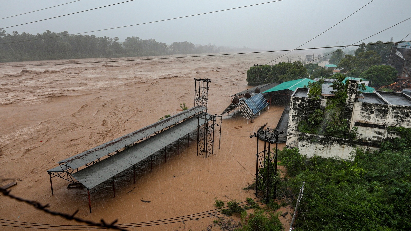
Monsoon conditions remain active across several regions
The intense rainfall over Gujarat came amid a broader spell of active monsoon conditions affecting several parts of India. Forecasts indicated that the monsoon would remain active over northwest and central India, adjoining areas of the northern peninsula, as well as eastern and northeastern parts of the country over the following three to four days.
Isolated heavy to very heavy rainfall, along with instances of extremely heavy rainfall, was expected in parts of Konkan and Goa, Gujarat, southeast Rajasthan and Madhya Maharashtra.
According to weather experts, the intensity of rainfall over south Gujarat was expected to ease as the atmospheric circulation moved towards Rajasthan. An intense cyclonic circulation over southeast Rajasthan and adjoining parts of Gujarat and Madhya Pradesh, combined with a wind-shear zone, had contributed to the extreme weather conditions observed in the region.
The Arabian Sea’s continued contribution of moisture was another important factor in sustaining rainfall over Valsad and other parts of southern Gujarat.
Extreme rainfall improves overall monsoon deficit
Despite the extraordinary rainfall in parts of Gujarat, India’s overall monsoon performance remained below normal. However, the intense spell helped narrow the country’s cumulative rainfall deficit to some extent.
The national monsoon deficit had improved to around 17 per cent below the long-period average, compared with a deficit of about 24 per cent recorded earlier in July. The improvement reflected the impact of heavy rainfall in several regions, although rainfall distribution continued to remain uneven across the country.
The weather department’s broader monsoon outlook had indicated the possibility of below-normal rainfall during July. The seasonal forecast also pointed towards rainfall below the long-period average, with El Niño conditions identified as one of the factors influencing the overall monsoon pattern.
The situation illustrates the uneven nature of India’s monsoon rainfall, where extremely heavy rain over a few locations can occur alongside prolonged deficits in other areas. Such variations can complicate water management, agriculture and disaster preparedness, particularly when rainfall is concentrated into short and intense bursts.
Extreme weather highlights growing importance of preparedness
The extraordinary rainfall recorded in Umergam serves as a reminder of the challenges posed by extreme weather events during the monsoon season. While heavy rainfall is an integral part of India’s annual monsoon cycle, exceptionally high rainfall over a short period can create serious risks for communities, infrastructure and transport networks.
For local authorities, such events underline the importance of timely weather warnings, effective drainage systems, flood preparedness and rapid emergency response. Residents in vulnerable areas are also advised to remain alert when authorities issue weather warnings, particularly when an area has already experienced exceptionally high rainfall.
As the weather systems move northwards, the immediate focus is expected to shift towards parts of Gujarat and Rajasthan that could receive further heavy rainfall. Meanwhile, the exceptional rainfall recorded in Umergam has emerged as a notable event in India’s monsoon history, reflecting the powerful interaction of multiple atmospheric systems and the continuing volatility of weather conditions across the country.