
A US-backed programme designed to monitor landslides, floods and other natural hazards in Nepal was shut down in January 2025 following funding cuts under the Donald Trump administration, more than a year before a devastating Himalayan disaster claimed more than 1,200 lives and left thousands of people missing.
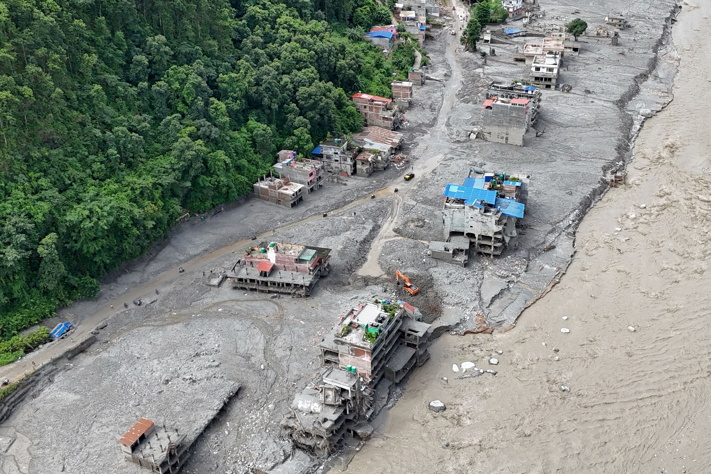
The closure of the disaster-monitoring initiative has come under renewed scrutiny after a massive ice-rock avalanche near the Nepal-Tibet border triggered a destructive wall of water and debris on August 26, 2026. The disaster swept through valleys, settlements and hydropower infrastructure, causing widespread destruction across northern Nepal.
The programme, known as SERVIR-Hindu Kush Himalaya, had spent years using satellite data and geospatial technology to identify areas vulnerable to landslides, floods and other environmental hazards. Its work was intended to help governments and communities understand changing risks and strengthen disaster preparedness.
The shutdown has prompted questions about the potential consequences of reducing investments in scientific monitoring systems in one of the world’s most disaster-prone mountain regions.
US-backed monitoring programme ended in 2025
SERVIR-Hindu Kush Himalaya was part of a broader international effort to use satellite observations, environmental data and geospatial technology to support disaster management.
The programme operated in the Hindu Kush Himalaya region, an area that includes some of the world’s highest and most geologically fragile mountains. Nepal, because of its steep terrain, rapidly changing glaciers and exposure to monsoon rainfall, has long faced serious risks from floods, landslides and other natural hazards.
The initiative worked on identifying vulnerable locations and developing tools that could help authorities understand how rainfall and environmental changes were affecting unstable slopes.
Its regional operations were brought to an end in January 2025 after US funding was cut as the Trump administration undertook a major restructuring of American foreign assistance.
The termination became particularly significant after the catastrophic disaster that struck Nepal in August 2026.
Deadly avalanche triggered devastating floods
On August 26, an enormous mass of ice and rock collapsed near the Nepal-Tibet border. The resulting surge of water, mud, rocks and debris moved rapidly through river valleys in northern Nepal.
The disaster caused extensive destruction in Rasuwa district and surrounding areas. Buildings, bridges, roads and other infrastructure were swept away, while hydropower facilities were severely damaged.
The scale and speed of the disaster left communities with little time to respond.
More than 1,200 people have been reported dead in Nepal, while thousands remain unaccounted for. The missing include local residents as well as foreign nationals who were travelling through the region, including people undertaking pilgrimage and trekking journeys.
Rescue teams have been working through enormous quantities of mud and debris to locate survivors and recover bodies.
Thousands of security personnel have been deployed, while helicopters, excavators and heavy machinery are being used to reach affected communities and infrastructure sites.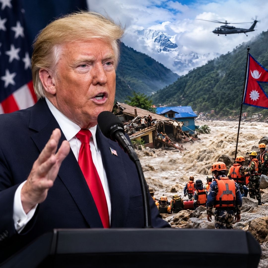
Could the monitoring programme have predicted the disaster?
The closure of the US-backed project has led to questions about whether its continued operation could have helped Nepal prepare for the August disaster.
Experts, however, have warned against assuming that the programme could have predicted the event or prevented the loss of life.
The disaster involved a sudden and complex combination of geological and glacial processes. Predicting the precise moment when a large mass of ice and rock will collapse remains extremely difficult, even with advanced satellite technology.
The importance of the programme was therefore not necessarily its ability to forecast every disaster.
Satellite-based monitoring can provide crucial information about changing landscapes, unstable slopes, rainfall patterns, flooding and damage following an event. Such information can help authorities identify vulnerable areas, assess the scale of destruction and determine where emergency assistance is most urgently needed.
The loss of that capability could therefore affect disaster preparedness and response even if the original event itself could not have been predicted.
Nepal’s challenging Himalayan geography
Nepal is particularly vulnerable to natural disasters because of its geography.
Large parts of the country are mountainous, with steep slopes and narrow valleys. Rivers originating in the Himalayas pass through settlements and infrastructure before flowing into the plains.
The region is also experiencing significant environmental changes.
Rising temperatures are affecting glaciers, snow cover and high-altitude ecosystems. Changes in rainfall patterns and increasingly intense weather events can further increase the risks of flooding and landslides.
These factors make continuous environmental monitoring increasingly important.
A disaster that begins in a remote mountain area can rapidly affect communities many kilometres downstream. Roads, bridges, communication networks and power infrastructure can be destroyed within minutes, making conventional ground-based monitoring difficult.
Satellite technology can provide an important alternative because it allows scientists and authorities to observe remote areas that may otherwise be inaccessible.
Disaster response complicated by destroyed infrastructure
The August disaster has presented enormous challenges for rescue workers.
The force of the flood destroyed roads and bridges, leaving several communities difficult to reach. In some locations, debris has buried buildings and infrastructure under layers of mud, rocks and other material.
Hydropower facilities have also been heavily affected.
Search teams have focused particular attention on tunnels and other areas where workers may have been trapped. Rescue operations have required heavy machinery and specialised teams capable of operating in dangerous and unstable conditions.
Communication has also emerged as a major challenge.
When floods destroy roads, electricity networks and communication infrastructure simultaneously, authorities can struggle to obtain accurate information about affected communities. This makes satellite imagery, remote sensing and alternative communication systems especially valuable during the immediate aftermath of a disaster.
Broader concerns over US foreign-aid cuts
The Nepal programme’s closure forms part of a wider debate surrounding the Trump administration’s changes to US foreign assistance.
After returning to office, Trump initiated a major review and restructuring of American foreign-aid programmes. Numerous initiatives faced funding reductions or termination as the administration sought to reduce spending and reorganise international assistance.
Supporters of the changes have argued that US foreign aid should be more closely aligned with American priorities.
Critics, however, have warned that cutting programmes focused on scientific research, disaster preparedness and environmental monitoring could leave vulnerable countries with fewer resources to respond to increasingly severe natural hazards.
The Nepal disaster has brought that debate into sharper focus.
Climate change adds to Himalayan risks
Scientists have increasingly warned that climate change is creating new challenges for Himalayan communities.
The Hindu Kush Himalaya contains enormous quantities of snow and ice, and changes in temperature can affect glaciers, snowmelt and the stability of mountain slopes.
Nepal is particularly exposed because many communities and major infrastructure projects are located downstream from high-altitude areas.
While climate change cannot automatically be identified as the sole cause of an individual disaster, warming conditions can contribute to changes in the environment that increase the vulnerability of glaciers and mountain landscapes.
The latest catastrophe has therefore renewed calls for greater investment in climate adaptation, early-warning systems and disaster preparedness across the Himalayan region.
Nepal plans to strengthen early-warning capabilities
The disaster has also highlighted weaknesses in existing early-warning infrastructure.
Nepal is now looking at ways to strengthen monitoring along its border with China. Proposed improvements include additional sensors, cameras, satellite-based communication equipment and other technologies designed to provide authorities with faster information during emergencies.
The objective is not necessarily to predict every landslide or glacial collapse.
Instead, authorities want systems capable of detecting dangerous developments quickly enough to give people and emergency agencies valuable minutes to respond.
For communities living downstream from unstable mountain environments, even a short warning could make a significant difference.
A lesson in the importance of preparedness
The devastating floods have demonstrated that disaster management cannot rely solely on emergency response after a catastrophe occurs.
Continuous monitoring, scientific research, satellite observation and local warning systems are important components of preparedness, particularly in regions where geographical conditions make ground-based surveillance difficult.
The termination of the SERVIR-Hindu Kush Himalaya programme does not prove that the August 2026 disaster could have been prevented. Nor does it establish that the programme would have predicted the avalanche before it happened.
However, the timing of its closure has raised broader questions about the long-term consequences of reducing investment in environmental monitoring in vulnerable regions.
As Nepal moves from rescue operations toward recovery and reconstruction, authorities face the difficult task of rebuilding damaged infrastructure while strengthening systems designed to reduce the impact of future disasters.
The catastrophe is likely to reinforce calls for stronger regional cooperation, better data sharing, advanced satellite monitoring and reliable early-warning networks across the Himalayas.
For a country repeatedly exposed to earthquakes, floods, landslides and glacial hazards, the lesson is clear: disaster preparedness requires sustained investment long before the next emergency begins.