
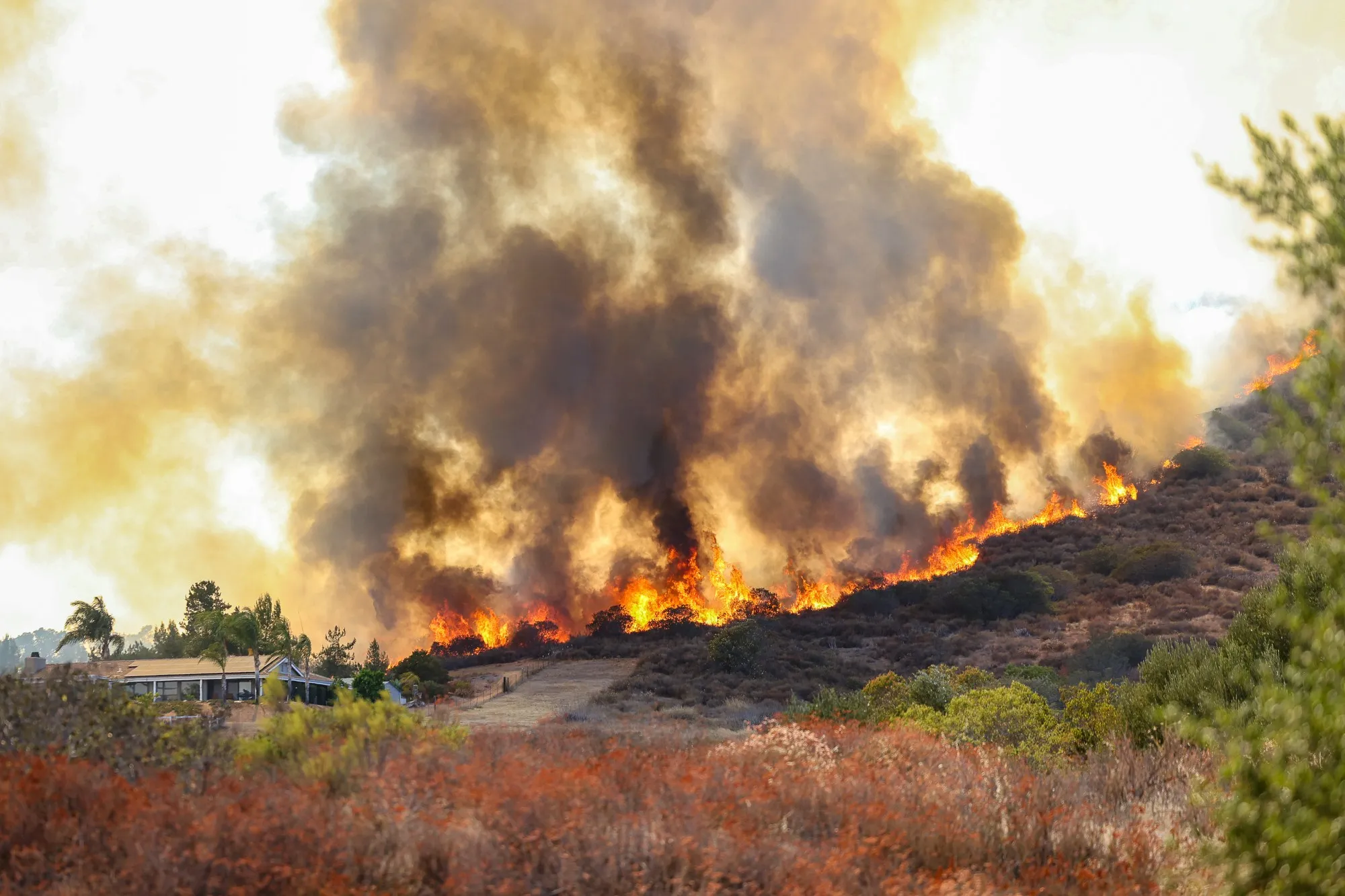
A rapidly spreading brush fire in Ramona, San Diego County, California, has prompted emergency evacuations as firefighters work to contain the blaze, which is threatening structures in and around a residential area.
The fire, reported in the vicinity of the 300 block of Creelman Lane, expanded quickly and raised concerns among residents as flames moved through light to medium vegetation. Authorities warned that the blaze was advancing at a critical and dangerous rate, prompting officials to issue evacuation alerts for communities in the surrounding area.
Multiple firefighting engines and crews were deployed to battle the fast-moving fire, while an aerial response was also reported as emergency teams attempted to slow the spread and protect homes and other structures. At the time of the latest update, officials had not announced any confirmed containment of the fire.
Evacuations ordered as fire threatens structures
Residents living close to Creelman Lane were placed under evacuation warnings as the fire intensified. The most serious alert, a Level 3 evacuation warning, was issued for several areas considered to be at immediate risk. Residents in these zones were urged to leave the area rather than wait for conditions to worsen.
The evacuation zone extended across areas north of Creelman Lane and into sections farther east and north as the fire continued to spread. The affected area reportedly reached toward Creelman Lake and extended in the direction of Gunn Stage Road.
The warning area also stretched north toward Julian Road and crossed portions of Old Julian Highway. Communities and locations around the Visa Ramona Highway were also included in the Level 3 evacuation zone.
Officials simultaneously placed other nearby neighborhoods under a Level 2 ‘Stay’ alert. The advisory urged residents to remain prepared, monitor developments closely and be ready to evacuate if conditions deteriorated or the warning level was raised.
The Level 2 alert included areas around Hanson Lane as well as sections near Gem Lane and Ashley Road.
Temporary evacuation centre established
As authorities worked to move residents away from the danger zone, a temporary evacuation centre was established at Ramona High School on Hanson Lane.
The emergency facility was intended to provide a safe location for people displaced by the wildfire. Authorities also made arrangements for residents with large animals, with the Ramona Rodeo on Aqua Lane identified as a sheltering location for livestock and other large animals.
The evacuation arrangements highlighted the broader challenges faced by communities during fast-moving wildfires, particularly in areas where homes and open vegetation exist close to one another. 
Fire spreads rapidly through dry vegetation
The blaze was described as moving at a critical to dangerous rate while burning through light to medium fuels. Such conditions can allow a wildfire to advance rapidly, particularly when dry vegetation provides a continuous path for flames.
The fire initially covered a smaller area before expanding significantly. The latest reports indicated that the blaze had grown to approximately 60 acres, underscoring the speed at which the situation developed.
The combination of rapidly spreading flames, threatened structures and changing evacuation boundaries created an evolving emergency for residents in the affected parts of Ramona.
Firefighters from multiple agencies responded to the incident, with ground crews supported by aerial operations. The air response was aimed at helping slow the fire’s advance and giving firefighters a better opportunity to protect threatened properties.
Thick smoke visible across the region
The wildfire also produced a large plume of dark smoke that could be seen from various parts of the surrounding region. Residents shared photographs and videos showing the smoke rising above the affected area.
Reports indicated that the smoke was visible across Ramona and could be seen from locations as far away as Escondido, reflecting the scale and intensity of the fire.
Social media footage and photographs circulated as residents documented the developing emergency, including images showing firefighting aircraft operating in the area.
While such visuals provided an indication of the fire’s intensity, officials continued to focus on evacuation operations, firefighting efforts and the protection of homes and other structures.
No containment confirmed in latest update
Despite the deployment of ground crews and aerial firefighting resources, there was no confirmed containment figure available in the latest update.
The absence of containment information meant that the situation remained fluid, with authorities continuing to assess the fire’s movement and potential threat to nearby communities.
Residents in areas under evacuation warnings were urged to follow official instructions and leave promptly when directed. Those under lower-level alerts were advised to remain vigilant and prepare for the possibility of an evacuation order if the fire expanded further.
The incident serves as another reminder of the challenges posed by fast-moving wildfires in California, where dry vegetation and rapidly changing fire conditions can quickly turn a localized blaze into a wider emergency.
Authorities and firefighting crews were expected to continue operations as they worked to prevent the fire from spreading further, protect threatened structures and improve containment. Updates on evacuation zones, fire progression and containment were expected as the emergency response continued.