
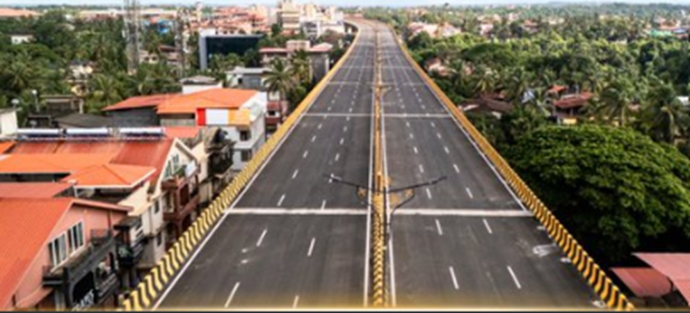
Authorities have restricted traffic movement on the newly opened Porvorim elevated corridor in Goa after a series of mishaps, including a car crash that killed two people, raised concerns about traffic management and the design of the corridor’s southern entry and exit.
The 5.15-kilometre elevated corridor was inaugurated on Wednesday and opened to traffic on Friday. Within days of its opening, authorities decided to temporarily restrict access while officials assess traffic movement, congestion and the operational performance of the new infrastructure.
The latest restrictions were imposed after a fatal accident on Saturday near the corridor’s southern end, where the road connects towards Panaji. The crash resulted in two deaths and has brought renewed attention to the design and safety arrangements at the entry and exit points.
According to officials, the accident was linked to difficulties associated with the entry and exit arrangement leading towards Panaji. The authorities have now begun monitoring the corridor more closely to determine whether changes are required before normal traffic operations resume.
Traffic restrictions imposed
The Goa Public Works Department has ordered the closure of access points leading towards the Atal Setu side of the corridor until further notice. The restrictions affect traffic travelling between Panaji and Porvorim as well as vehicles heading towards the popular beach belt in North Goa.
Two-wheelers have also been prohibited from using the elevated corridor under the temporary traffic arrangement.
Officials said the decision was taken to allow authorities to study actual traffic behaviour following the opening of the corridor. The monitoring exercise will examine several factors, including travel times, queue lengths, congestion, traffic diversions and overall movement across the corridor and surrounding road network.
The authorities are expected to use the findings to determine how traffic should be managed and whether additional measures are required to improve safety and efficiency.
Corridor was built to ease long-standing congestion
The Porvorim elevated corridor was conceived as an important road infrastructure project aimed at addressing persistent traffic congestion along one of Goa’s busiest stretches.
The corridor connects the Mumbai-Goa highway towards Panaji and was expected to provide a faster route for motorists travelling between Porvorim, Panaji and other parts of the state. It was also expected to improve connectivity towards North Goa’s major tourist destinations, including the coastal areas around Calangute and Anjuna, as well as Mopa airport.
The project was constructed at an estimated cost of ₹364.68 crore. Work began in January 2024 after procedural delays.
The infrastructure was considered particularly important because the Porvorim-Panaji route has experienced significant congestion for years. Authorities had hoped that shifting a portion of the traffic onto the elevated corridor would reduce pressure on existing roads and shorten travel times.
Opening ahead of Ganesh Chaturthi
The state government had been keen to make the corridor operational before the Ganesh Chaturthi festival, when traffic volumes were expected to rise.
Although finishing work on parts of the project was still continuing, authorities had maintained that the structure could be opened from a traffic-management perspective. Officials had said remaining work would continue even after traffic was allowed to use the corridor.
The opening was therefore viewed as an important step towards improving connectivity in the Porvorim-Panaji region. However, the accidents reported shortly after the launch have now prompted authorities to reassess how vehicles enter, leave and move through the facility.
Safety concerns emerge after opening
The decision to restrict traffic so soon after the corridor became operational has placed greater focus on road safety and traffic planning.
The southern end of the corridor, particularly the connection towards Panaji, has emerged as a key area of concern following the fatal crash. Officials are now examining how traffic interacts with the corridor’s access points and adjoining roads.
The monitoring process is also expected to provide authorities with information on whether traffic is building up at particular points or whether motorists are facing difficulties while entering or exiting the elevated route.
The restrictions are being treated as a temporary measure, with officials expected to continue observing traffic conditions before deciding on the next course of action.
Project was expected to improve travel for commuters
Before its opening, the elevated corridor was projected to provide considerable relief to daily commuters travelling between Panaji and Mapusa and through Porvorim.
State officials had described the project as a major connectivity improvement that could reduce travel time and make daily journeys easier for people travelling to offices, schools and other destinations.
The corridor was also expected to support smoother movement towards Goa’s tourism-heavy northern areas, where road congestion can become particularly challenging during busy periods.
However, the immediate safety concerns have shifted attention from the corridor’s intended benefits to the need for careful traffic management and safe integration with the existing road network.
Authorities to monitor corridor before further decision
For now, access towards the Atal Setu side remains restricted as authorities study traffic conditions. The monitoring exercise will focus not only on the elevated structure but also on the wider network connected to it.
Officials will assess congestion levels, traffic queues, travel times and diversion patterns before determining how the corridor should operate in the future.
The development comes only days after the project’s formal inauguration and highlights the challenges authorities can face when introducing major road infrastructure into an already busy urban traffic network.
The immediate priority is expected to be ensuring that motorists can use the corridor safely while allowing officials to identify and address any problems associated with its design, access points or surrounding traffic movement.