
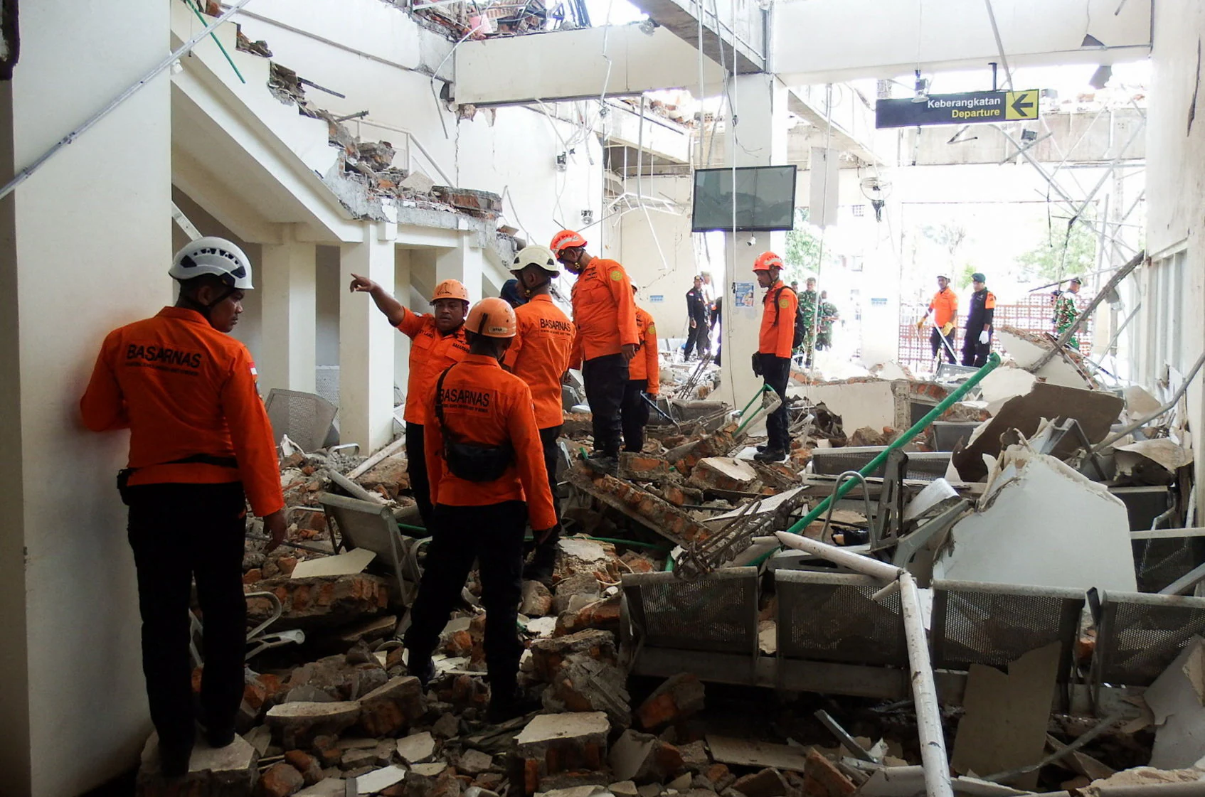
A powerful 7.7-magnitude earthquake struck eastern Indonesia early Saturday, killing at least 20 people and injuring several others as violent shaking caused buildings and homes to collapse across parts of Flores Island.
The earthquake struck off the northern coast of Flores in East Nusa Tenggara province, one of Indonesia’s regions highly exposed to seismic activity. The strong tremor sent residents rushing out of homes and other buildings, while emergency authorities launched search-and-rescue operations in areas affected by structural damage and landslides.
The disaster also prompted authorities to issue a tsunami warning for vulnerable coastal areas. The warning was later lifted after the immediate threat had passed, although small tsunami waves of less than one metre were recorded in several locations.
Rescue teams search for survivors
The largest number of casualties was reported around Maumere, the main town in Sikka Regency on Flores Island. Rescue workers recovered 20 bodies and reported several injuries, while efforts continued to locate people who may still be trapped beneath rubble.
The scale of the destruction remained under assessment as emergency teams moved into affected communities. Authorities warned that the casualty figures could change as rescuers reach areas that were initially difficult to access.
The earthquake caused extensive damage to homes, warehouses and government facilities. Some buildings were badly damaged or collapsed completely, leaving residents concerned about further structural failures during continuing aftershocks.
Emergency workers have had to operate under difficult conditions because roads were blocked by landslides in some areas and communication networks were disrupted.
Nagekeo faces major access problems
Nagekeo, located close to the earthquake’s epicentre, was among the areas where authorities faced serious difficulties in reaching affected communities.
Road access was disrupted by landslides, while damaged communication networks made it difficult to establish the full extent of the destruction. Rescue teams attempted to reach the area despite the obstacles, including efforts to use alternative transport routes.
Around 2,000 residents in Nagekeo were evacuated following the earthquake. People moved away from potentially unstable buildings and coastal locations as authorities responded to both the earthquake and the initial tsunami threat.
Damage assessments were continuing across the region, with officials checking residential areas, public facilities and other structures for signs of serious damage.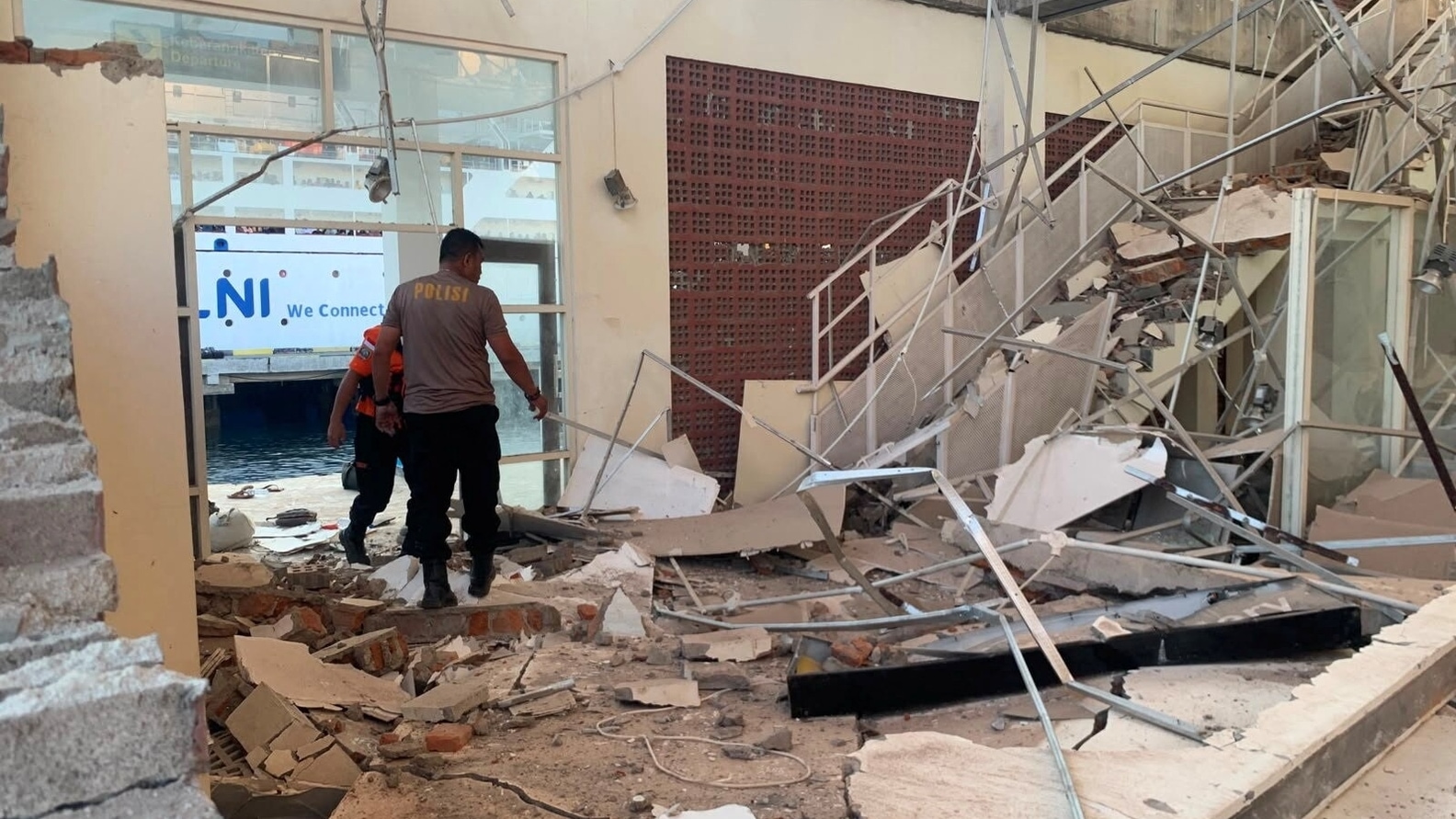
Tsunami warning issued after undersea earthquake
The earthquake occurred offshore, raising immediate concerns about the possibility of tsunami waves. Authorities responded by issuing a tsunami warning and urging residents in vulnerable coastal areas to move to safer locations and higher ground.
The warning created widespread panic, particularly among residents who had already experienced intense shaking. People rushed away from coastal areas while emergency officials monitored sea levels and seismic activity.
Small tsunami waves measuring less than one metre were subsequently observed in some areas. After several hours of monitoring, authorities lifted the tsunami warning after determining that the immediate threat had subsided.
The cancellation of the warning allowed some residents to begin returning to safer areas, although officials continued to urge caution because strong aftershocks remained possible.
Strong aftershocks complicate rescue operations
The main earthquake was followed by numerous aftershocks, including a strong tremor measured at magnitude 6.1. The continuing seismic activity created additional risks for residents and rescue personnel.
Aftershocks can cause already weakened buildings to collapse, making rescue operations particularly dangerous. Emergency teams therefore have to balance the urgency of locating survivors with the need to ensure that rescue workers are not exposed to unstable structures.
The continuing tremors also increased anxiety among people who had left their homes. Many residents remained outdoors or in temporary safe locations rather than returning immediately to damaged buildings.
Hospitals and infrastructure affected
The earthquake disrupted essential services in several parts of the affected region. Power outages were reported, while communication problems made it harder for authorities to coordinate emergency operations.
Some medical facilities also experienced difficulties after the earthquake. Patients were moved away from potentially unsafe buildings in some locations, while medical workers prepared to provide treatment under emergency conditions.
Roads were also affected by landslides, including routes connecting communities across Flores. The disruption created additional challenges for ambulances, rescue teams and vehicles carrying emergency supplies.
Residents flee as buildings shake
The intensity of the earthquake caused widespread fear among residents. People ran outside their homes as the ground shook, while falling debris and cracks in buildings added to the danger.
In some affected areas, people gathered in open spaces because of fears that damaged structures could collapse during aftershocks.
The earthquake occurred early in the morning, when many people were inside their homes or sleeping. This increased the danger posed by falling debris and collapsing structures.
Images and videos from affected areas showed damaged buildings and residents gathering outside as emergency workers began assessing the destruction.
Flores remains vulnerable to earthquakes
Indonesia is among the world’s most earthquake-prone countries because it lies along the seismically active Pacific Ring of Fire. The country is situated near several major tectonic boundaries, making earthquakes and volcanic activity relatively common.
Flores has a history of destructive earthquakes and tsunamis. The latest earthquake has again highlighted the vulnerability of communities living along the island’s coast and in mountainous areas where landslides can quickly cut off roads.
The region’s geography also creates additional challenges for disaster response. Communities are spread across coastal and mountainous areas, while roads can be narrow and vulnerable to landslides following strong seismic activity.
Emergency response continues
Search-and-rescue teams continued working across the affected areas as authorities attempted to determine the full extent of the damage.
The immediate priorities include locating missing people, treating the injured, providing shelter to displaced residents and restoring access to communities cut off by landslides or damaged roads.
Authorities are also inspecting buildings to determine whether they remain structurally safe. Residents have been advised to avoid entering badly damaged structures because further aftershocks could cause additional collapses.
With the death toll already at 20 and rescue operations still underway, officials remain concerned that casualties and damage estimates could rise as teams reach more remote areas.
The powerful earthquake has left parts of Flores facing a major emergency, with communities dealing simultaneously with damaged homes, disrupted infrastructure, continuing aftershocks and the psychological impact of a sudden and destructive natural disaster.
For now, rescue and relief operations remain the central focus as emergency workers search damaged areas for survivors and authorities work to provide assistance to thousands of residents affected by the earthquake.